How much does a drone survey cost in Pune?
Drone survey pricing depends on site area, terrain, accuracy required (RTK vs standard), and deliverables (orthomosaic, contour map, DTM/DSM, CAD/GIS files). Small plots are quoted as a flat package; larger area and corridor surveys are priced per acre or per project. Call +91 93710 44204 or WhatsApp +91 99224 68407 for an itemised quote within 24 hours.
What is the drone survey cost per acre in India?
As a starting guide, a basic aerial survey (orthomosaic, ~2–3 cm GSD) starts at around ₹2,000 per acre, a topographic survey with DSM/DTM and contours from around ₹3,000 per acre, and a volumetric (stockpile / cut-fill) survey from around ₹4,000 per acre. Detailed GCP-corrected mapping and large or restricted sites are quoted individually. A minimum site charge applies. See the pricing table above for the full breakdown.
Why does per-acre survey pricing vary?
Per-acre rates change with the deliverable (a plain orthomosaic costs less than full contours or volumetrics), the accuracy required (RTK and ground control points add field time), site access and terrain, flight permissions for restricted airspace, and total area — larger sites bring the per-acre rate down. We confirm the exact rate after reviewing your site location and scope.
Is there a minimum charge for small sites?
Yes. Very small plots are quoted as a flat package rather than strictly per acre, because mobilisation, flight setup, processing and reporting time stay roughly fixed regardless of size. For small sites we give a single all-inclusive figure; for larger sites the per-acre rate applies above the minimum.
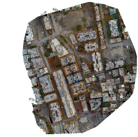
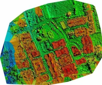
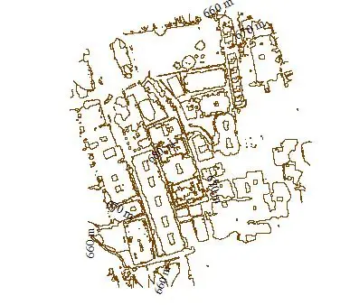
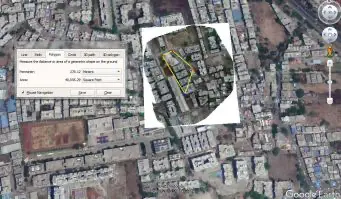
What deliverables do you provide with a drone survey?
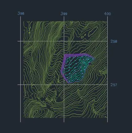
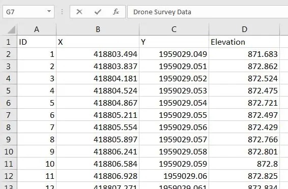
Geo-referenced orthomosaics, DTM/DSM, contour maps, volumetric reports, and CAD (DWG/DXF) and GIS (KML/SHP) outputs — RTK-corrected to centimetre level where required, compatible with AutoCAD and GIS software.
Do you offer drone survey services near me in Pune and PCMC?
Yes. We are a Pune-based drone survey company and mobilise across Pune, PCMC, Hinjawadi, Baner, Wakad, Navi Mumbai, Thane, Nashik and Nagpur — often same or next day for nearby sites, and pan-India for larger projects.
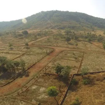
What types of drone survey do you carry out?
Topographic, contour, volumetric/stockpile, land and boundary, road and corridor, construction/as-built, and 3D mapping / photogrammetry — all from RTK-corrected drone data with CAD and GIS deliverables.
Are your drone surveys DGCA compliant?
Yes. All flights are conducted under Drone Rules 2021 (CAR Section 3, Series X) by certified Remote Pilots, with public liability insurance and all airspace permissions handled by us.