 AerialPhotoIndia
Construction Progress Monitoring from the Air
Periodic drone documentation for developers, contractors and project managers — aerial reports, orthomosaic maps, 4K timelapse and 360° site records. DGCA licensed, flying since 2010.
Aerial documentation from live construction sites
Real progress flights across Pune, Shirval, Talegaon and Sangli — orthomosaic outputs, infrastructure tracking and industrial site overviews. Tap any frame to enlarge.


Seven ways drone monitoring keeps your project on schedule
Real-time progress measurements
Accurate aerial measurements of progress, material stockpiles and resource deployment. Periodic reports keep managers informed without a site visit.
High-resolution imagery & 4K video
4K drone photography and video from multiple angles and elevations — a detailed visual record of every construction stage.
Orthomosaic maps & geo-tagged data
Geo-tagged orthomosaic maps let you track structural change over time, compare against drawings and update as-built models instantly.
Automated reports & dashboards
Progress reports highlighting completion percentages and schedule deviations — ready to share with developers, architects and investors.
Aerial timelapse videos
Timelapse sequences capturing the whole lifecycle from groundbreaking to handover — ideal for marketing and investor presentations.
360° virtual site tours
Aerial and ground-level 360° documentation, letting remote stakeholders assess site condition without being physically present.
Rooftop & structural inspections
Thermal and visual drone inspections of completed structures, rooftops and facades. See facade inspection ›
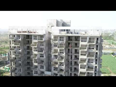
Construction monitoring drone footage
Plan a progress-monitoring flight
Drop a line or give us a ring — we'll get back to you with a flight plan and packages.
- Phone
- +91 93710 44204
- +91 99224 68407
- tejas@aerialphotoindia.com
- Studio
- NH4, opposite Navale Hospital, Pune 411041